

FLOOD ALERTING LEVELS
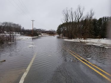
Flood Advisory: Minor flooding is possible and rivers are forecast to exceed bankfull.
Flood Watch: Conditions are favorable for flooding. It does not mean flooding will occur, but it is possible.
Flood Warning: Flooding is imminent or occurring.
HOW TO MONITOR RIVER LEVELS
A system of United States Geological Survey streamgages exists across Michigan and is linked with a real-time remote monitoring system through the internet (http://water.weather.gov/ahps/). Most streamgages commonly measure the stage and volume of water flowing through rivers. Live updates and old records from the streamgages are available online. Local, State, and Federal agencies rely on the data for flood forecasting and issuing permits. Along the Muskegon River there are four USGS streamgages, one in the City of Evart, one near Croton below the Croton Dam, one in the City of Newaygo at Bridge Street, and one in Bridgeton at the Bridgeton Township Boat Launch located at Warner Bridge.
Flood Inundation Mapping Program
Newaygo County is now participating in the United States Geological Survey (USGS) Flood Inundation Mapper System. This system will allow emergency officials to detect threatening flood events in advance, enabling officials to disseminate meaningful warnings to the at-risk public so that actions can be taken to reduce the adverse effects of the flood event to save lives and protect property.
The FIM Mapper allows users to explore the full set of inundation maps that shows where flooding would occur given a selected stream condition. Users can also access historical flood information based on the severity of the flood. The FIM Mapper helps communities visualize potential flooding scenarios, identify areas and resources that may be at risk, and enhance their local response effort during a flooding event.

